Hey, Al. . . that's Inconvenient

CAPE CANAVERAL - Studies that link a spike in hurricane intensity with global warming are spotting "artificial upward trends" because they rely on bad historical data, a paper suggested today in the journal Science.
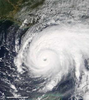
Hurricane intensity is measured by the storms' surface winds. Sometimes those winds are estimated by looking at satellite pictures, using a subjective technique invented in 1972.
Better technology since then, including greater satellite coverage, has led inevitably to higher wind-speed estimates for more recent storms, the authors suggest.
"The resulting higher resolution images and more direct overhead views of tropical cyclones result in greater and more accurate intensity estimates in recent years when using the Dvorak Technique," according to authors Christopher Landsea of the National Hurricane Center, Bruce Harper, Karl Hoarau and John Knaff.
For example, Hurricane Hugo's strength was underestimated based on images taken from an angle, and similar errors probably occurred frequently in the 1970s and 1980s, when there was less satellite coverage, the authors write.
While there may be trends in storm intensity linked to sea temperatures, which have increased, the "trends are very likely to be much smaller (or even negligible) than those found in the recent studies," the paper says.
An ongoing overhaul of the hurricane database may make it easier to quantify storm trends, the authors say


0 Comments:
Post a Comment
<< Home